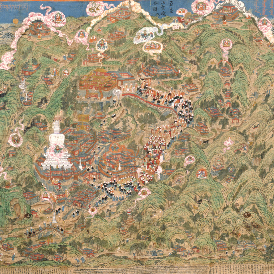
Lhundrup
Cifu Temple (慈福寺), Wutaishan, Shanxi Province, China
1846
Lhundrup
Cifu Temple (慈福寺), Wutaishan, Shanxi Province, China
1846
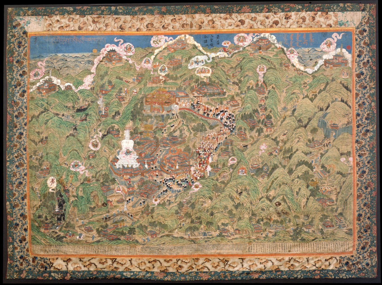
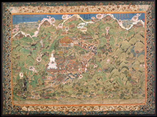
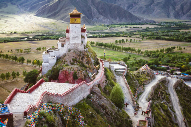
The sacred mountain Wutai (Wutaishan 五臺山), located in Shanxi Province, China, is believed to be the earthly abode of the bodhisattva of wisdom Manjushri. Mount Wutai was a sacred site to Chinese Buddhists as far back as the fifth century. From the seventh century on, it became an international pilgrimage center, attracting Buddhist pilgrims from as far away as India, Kashmir, Tibet, Japan, and Korea. While Tibetan Buddhism was firmly established on Mount Wutai during the Mongol Yuan dynasty (1271–1368), by the 18th and 19th centuries Mount Wutai had become especially important to Tibetans, Mongols, and Manchus.
This panoramic view of Mount Wutai is an impressive, six-foot-wide woodblock print on cloth that has been hand colored. There are some 30 known surviving prints of this map. It was carved on Mount Wutai in 1846 by a Mongolian monk named Lhundrup at a local monastery, Cifu Temple (慈福寺), which served as the main lodging for Mongolian monks visiting the mountain.
This map contains more than 150 sites of interest to the pilgrims who ventured to Mount Wutai. These sites are labeled with Chinese and Tibetan inscriptions, including Buddhist monasteries, Taoist temples, villages, sacred objects, and locations of events, both historic and miraculous. Winding paths with tiny travelers link one temple to another, suggesting possible itineraries of pilgrimage. Pilgrims traveled this sacred mountain to see divine visions, which took the form of miraculous light and cloud formations, a ubiquitous presence on this map. The most prominent monastery, Bodhisattva Peak Monastery (Pusa Ding), appears much larger than the others. This temple was converted into a Manchu imperial establishment shortly after the Qing dynasty was founded in the mid-17th century, which is denoted by its bright yellow roof.
A masked dance procession, the focus of ritual activity on the mountain, leads from the monastery down the center of the map. The content of the sites and events marked on the map are a complex historical layering of Chinese, Tibetan, Mongol, and Manchu involvement on the mountain. Many Mongols were ardent followers of the Gelukpa, the monastic order of the Dalai Lama, and this map asserts not only a Tibetan Buddhist religious identity but, more specifically, a Gelukpa identity to Mount Wutai. The Gelukpa founder, Tsongkhapa (1357–1419), who was considered a Tibetan emanation of Manjushri, can be found everywhere on the map, including visions of him emanating on clouds from Mount Wutai’s five peaks. Thus, this map declares both an ethnic and sectarian identity.
The trilingual dedicatory inscriptions at the bottom promise the benefits of seeing this image, including being free from all calamities and diseases, and enjoying boundless blessings, happiness, and longevity.
A vehicle for the preservation and transmission of knowledge. The Buddha’s teachings were originally passed down through oral transmission and storytelling, and stories of the Buddha’s past lives are considered an important source of inspiration and guidance.
A meditation technique primarily used in tantric practice that involves imagining a deity in one’s mind or imagining oneself becoming a deity and carrying out various activities. Such techniques are intended to help a practitioner transform ordinary perception and achieve enlightened qualities.
Although Tibetan Buddhism was not practiced broadly in China, the imperial centers, such as Beijing and Mount Wutai, emerged as hubs of Tibetan Buddhist cultural production. The emperors of the Mongol Yuan (1271–1368), Chinese Ming (1368–1644), and Manchu Qing (1644–1911) dynasties harnessed Tibetan Buddhist ideas to consolidate their power.
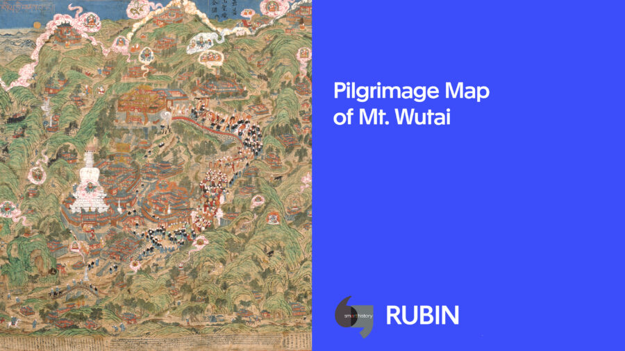
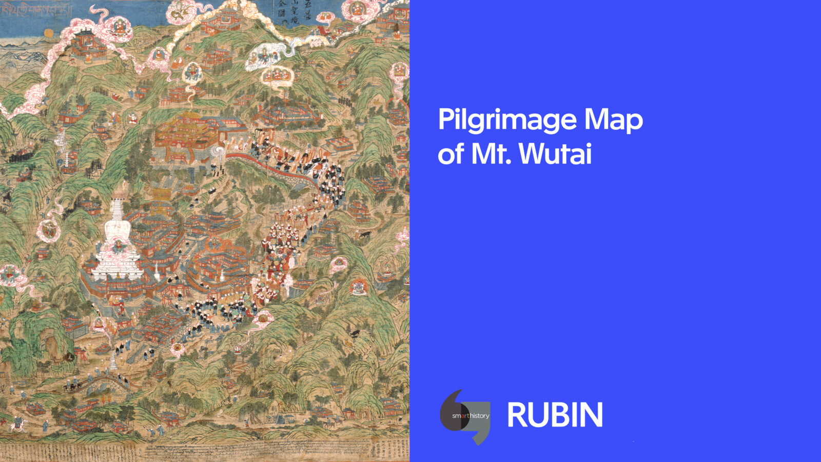
Transcultural Visions of a Buddhist MountainCifu Temple, Mount Wutai, China
People across the Himalayan regions interacted with their surroundings driven by various motivations or purposes, developing diverse architectural styles.
Himalayan art spans the artistic traditions of the diverse regions and cultural spheres of the greater Himalayan mountain range, the Tibetan Plateau, and connected areas of Inner Asia.
Get the latest news and stories from the Rubin, plus occasional information on how to support our work.